Monday, January 5th
The Thrall of the Mountains
‘That’s gonna be hot,’ the waitress said after inquiring into my travel plans for the day. For now, it was rather pleasant. Twenty two degrees, sunny, a light breeze, and I decided to have breakfast outside. Maybe only to annoy my readers way north.
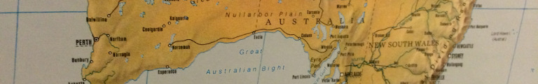
By nine I was ready to rock and roll, as one of these readers was fond of saying, or at least to get back onto the road. It was an half-hour drive back to the main highway. As I neared the intersection, the dark outline of a mountain started to appear hazily in the far away distance, a lone, tall mountain with a sheared off top. Soon it morphed into a small mountain range. Three peaks became visible, two large ones and a smaller sibling. They didn’t seem to be altogether that far away any more, either. The map suggested that they may have been Stirling Range, which meant they were about thirty kilometres to the west.
The range slowly wandered off to the right as I drove onwards through a landscape of grassland or forests, now with pale green trees. According to the map and the signs pointing to various beaches (sadly all along unsealed roads), the highway kept a distance of about ten kilometres from the ocean.
A new lone mountain appeared to the left. Presumably, this was Mount Manypeaks, a long flat affair which one could indeed have interpreted as having many a peak. There was a village by the same name, really just a school and a store surrounded by fields and tree groves.
As the road slowly turned towards the coast, tourism country began: The first vineyard, a sign directing to caravan parks (plural!), a multitude of other dubious attraction. Albany beckoned.
Serving as the centre of the whole area, it turned out the be a confusing mess of roundabouts and shops and cars and people. Its main street wasn’t particularly pretty, hardly any green, only concrete and a rare glimpse of sandstone. I didn’t make it all the way down to the ocean shore before I took advantage of a suddenly appearing roundabout and fled.
The prudent thing would have been to drive along the coast westwards, to Denmark (the Western Australian town, not the country) and beyond. But those damn mountains were nagging and pulling. So I turned north instead and onto the main road towards Perth. It was busy for a while, but a few miles onwards, traffic had calmed down considerably.
Much like the dreadful pictures of lung cancer decorating the local cigarette packs (or so I seem to remember being told once), the wrecks of cars were placed here and there on poles next to oft-used roads like this one with catchy slogans such as ‘Fatigue kills.’
At Mt. Barker, the next town, I made a quick supply stop. Unlike in America, where even the shabbiest of motels includes breakfast these days, the early meal was extra here and quite a bit extra no less. But eventually it had occurred to me that the typical American motel breakfast (or at least the part I was normally perusing) was easy to fake. All I needed was some bread and some strawberry jam since coffee brewing facilities had so far always been available in the rooms. Add to that some plastic knifes and spoons and perhaps a fruit cup, et voilà: breakfast. Since I was here, I also stocked up on water. It was bound to become hot, after all.
I then turned right off the main highway and towards Porongurup. Soon, a mountain range appeared on the right side. These mountains looked real, with barren dark, almost black rock formations for their upper sides and tops. The range wasn’t very large, perhaps ten kilometres long with five peaks.
The road ran by a few kilometres north and arrived in Porongurup (say that five times fast or, in fact, type correctly). The first building was a tea room slash arts and crafts store. ’Nough said. There followed the Country Ranch with cottages and cabins and the Porongurup Range Tourist Park. So, those mountains probably were Porongurup Range.
After town, the road closed in on the range and eventually pointed to Castle Rock Sky Walk. Dutifully I turned off to the right, went on for about three hundred metres up the hill and arrived at a parking lot and a sign demanding I paid my fees. Well, would I ever. I decided against a sky walk on account of it being thirty three Celsius and me being cheap. Also, there was still those real mountains in the north.
I turned towards them and soon they appeared in the misty distance. Slowly they grew and became less hazy and more real. Eventually, the road entered into a lush forest and started to climb. It seemed to plot a way a wide low part that separated the range in two. There were a line of mountains to the left and right side each, both a few miles away. A drive was pointed out through the left part but sadly it was on an unsealed road.
For the rental car driver, the map suggested a sealed road up to a mountain called Bluff Knoll. The map didn’t bother with giving altitudes, but the guide kindly suggested 1095 metres and named it the highest peak in the south west. To get there, one had to pass yet another fee collection point. I bargained with myself for a while but finally coughed up the twelve dollars.
The road wound up the mountain for a bit but ended at something called Eastern Lookout. I parked the car and went to look out. Behind me arrived a Spanish couple with the tiniest of caravans, using one of these ridiculously small Japanese vans as its base. But the contraption had Victoria plates, so the had come quite a long way with it, even went along roads I apparently was too chicken to take.
There was indeed a fantastic view towards the east over the other part of the range and the long, green valley in between. Behind to the west loomed Bluff Knoll, sticking its bald, rocky head out of the green. There was a 3.1 kilometre trail up to its top. More bargaining, but I decided against it. I hadn’t brought my hiking boots thinking it would be too hot for hikes. It was indeed to hot for hikes. The sign suggested a three to four hour round trip (even though it should have been doable in two hours even in this sort of weather) and it was almost two in the afternoon already. But the real deal breaker was the armada of flies that was everywhere. They would have made any hike a terrible ordeal, even if one could probably see all the way to the ocean from up top.
Back in the car (the process of entering now perfected enough to the point were I had only one fly to kill), I poured over the map to figure out a good overnight location. I could either loop back to the coast and go to Denmark (the Western Australian town, not the country) after all, or aim west and see how far I would get. I eventually decided for the latter. Not that I have anything against Denmark, town or country.
First, though, further north. The range ended rather quickly and with it the trees and it was back to busy farmland. The fields here were so big, the farmers had mobile grain elevators they dragged into them. The grain then would be picked up by a road train and delivered to the next bin.
That would likely be in Borden where I now stopped for an afternoon coffee. The one offered by the General Store (please do your own salute)—brewing involved a long trip to the far end of the store—was pretty good.
I tried to repeat yesterdays stroll through town. It was thirty seven Celsius, or an even hundred Fahrenheit, which really is pretty darn hot. But I could have coped with that. The flies, I couldn’t. By now I wished I had indeed afforded a hat with some cork dangling off its rim, silly look or not.
I retreated to the safety of the car, turned the ventilation up to full and enjoyed my coffee there. From here, the village looked rather agreeable. Across from the General Store was the bin and a park had been placed in between. There was a pavilion with some benches and a barbie under a few trees. There was a public lavatory, something all villages and towns seemed to have, doubling as an information point with a few displays mounted along its walls. Down the road was Borden Tavern, conjuring images of a rowdy evening in the bush.
North of town the road west turned off. A sign pointed to a rest area and suggested a photo opportunity. Feeling slightly sceptical, I still obeyed, went for it, and arrived at Lewis’ Lookout. The view it presented quickly erased all scepticism: off in the distance was the Stirling Range in its entirety, perfectly fitting into the phone camera’s view. There even was a plaque labelling all the peaks. But there also was a plague, namely that of flies. I held still long enough to quickly snap my pictures, removed the flies from nose, ears, and glasses and jumped back into the car.
In Gnowangerup, the thermometer reached thirty eight. At the intersection with the north-south road to Katanning, it reached thirty nine and the asphalt looked wet. But all was not lost. The sky started to fill with scattered clouds.
In Broomehill a sign indicated a shortcut to Kojonup. This sounded good, indeed, and I turned left into the next street. Immediately, the asphalt disintegrated noisily under my wheels. Maybe a small side road wasn’t such a good idea after all. Slowly I returned to the bigger highway.
The clouds became more and more. After Katanning, praised by a series of signs upon approaching but sadly off to the highway’s right, and Kojonup, down a hill with shops in various pretty old buildings, they started to look slightly menacing.
Suddenly, rain drops started to drum onto my wind screen. This felt entirely wrong. The thermometer still showed thirty eight degrees, the sun was bathing the landscape in bright light, but there was rain.
Not for long. Soon all signs of it had disappeared and it was forgotten. Before reaching Boyup Brook even the clouds had gone again and the sky was innocently blue.
Boyup Brook, styled as the Country Music Capital of Western Australia by my map, started with lots and lots of trees. It continued like this all the way to the centre. There wasn’t much, a few shops, a Country Music Museum, but all was surrounded by bushes and trees. This was more like a large park that someone had hurriedly added a few houses too. And did I mention the trees?
The road out of town ran up a hill, through a series of fields and eventually I realized I was driving through a dark, dense forest. I couldn’t quite remember when that had started. This was certainly a good indication that I had had enough.
At the end of the forest was Bridgetown, down in the valley of the Blackwood River. The guidebook (as for once my chosen overnight stay actually was included in it) suggested the Bridgetown Hotel in a real renovated 1920s hotel. It had a room available. I climbed up the stairs and out onto that mysterious second storey balcony I had seen so often.
It was even better than I had imagined. The balcony doubled as the hallway towards the rooms. It was rather wide, three metres perhaps. This not only left enough room for tables and deck chairs, but also set back the rooms, dampening the noise from the street. I considered sitting out on the balcony with the laptop but then ashamedly voted for the air conditioned room.
When I was done writing, nine had gone by and the town had turned quiet.
There was only the crickets chirping and the rare car going by.
I went downstairs just in time before everyone went home, got myself a
beer, went up again, poured my beer, and finally went out onto the
balcony.
Sitting out there with a pint of pale ale in the quiet evening heat, I decided that maybe, just maybe the world wasn’t such a bad place after all.