Friday, May 14th
The Long Road
The night is my companion
And solitude my guide
Would I spend forever here
And not be satisfied— Sarah McLachlan, Possession
Back in the sixteenth century, when Jacques Cartier went to discover what is now Quebec, he had with him a native guide who told him a story of a great rich kingdom full of gold and precious stones up what is now the Saguenay River and further on. For decades after Cartier, European explorers went searching for this kingdom but they never found anything. Today, I shall take the road up beyond Lac Saint-Jean and have a look myself. And so, I leave the ocean behind for now and start travelling inland.
Actually, I wanted to start the day with visiting the historic village of Val-Jalbert, but I forget. Instead, I take off north. In keeping with the pattern of a bad day following a nice one, it is overcast, but no evil clouds so far.
Lots of cars have little flags mounted to their windows. These would bear the symbol of the Les Canadiens, a Montreal hockey team which just managed to win the quarter finals. Apparently, things went a bit wild in Montreal where 41 people were arrested. But just to be safe, I parked my car last night next to one with Ontario license plates. The crowd, should it show up, will definitely pick those first.
At Saint-Félicien, the road north branches off. It first runs by the Zoo Sauvage de Saint-Félicien and then the Autodrome de Saint-Félicien. The distance marker indicates “Chibougamau 232 km”. Which is a bit of a ride. Accordingly, I top up the tank in Le Doré. Shortly before end of civilization at km 30 of the road, a sign indicates that the next fuel stop will be 191 km away. Which is a bit of a lie as the next petrol station is only 500 metres down the road
But after that wilderness ensues. There still are occasional signs of human life: a visitor centre at the entrance to the Réserve faunique Ashuapmushuan—a wilderness reserve along most of the road and subsequently huge—, some antennas on top of mountains, the odd cabin. Also every once in a while there is an emergency telephone booth. But at up to fifty kilometres apart, walking to next one is not necessarily an option.
The road is surprisingly busy, particularly with trucks. Most of them seem to be of a brand called Mack, which incidentally is also the name of a beer from Tromsø, Norway. (All right, the next thing I do is travel through Norway and write a travelogue comparing everything to Canada. Fair is fair.) Soon I am stuck behind a mini convoy of two trucks and two cars. They are actually going at a good speed, but changing speed rather often which makes it impossibly to drive comfortably with the cruise control on. So I make a short stop and let them get ahead a bit, the set the speed to a hundred which I guessed was the average. Et voilà, relaxed driving achieved.
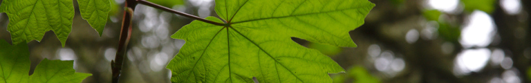
The landscape is either mountains or plateaus. All of it is a huge forest, which goes on all the way north to the Hudson Strait. Most trees are of a coniferous nature, but there are lots of birches as well. In between there are millions of lakes, some small, some huge. Occasionally, we also cross might rivers.
Apart from the road, there is also a railway line. It takes a bit different course, but every once in a while it comes close to the road.
At km 187, we enter the municipality of Baie-James, which actually goes all the way to James Bay and with almost 300,000 square kilometres is the largest municipality in the world.
At km 204, a sign announces the good news that there will be a McDonald’s in Chibougamau, now 27 km ahead.
Finally, at km 211 the first settlement indicates the immanent end of wilderness. Nine kilometres further at Lac Cache, the road west branches off. Only few kilometres left now.
Chibougamau is a very special place for people in southern Quebec. They grew up with a big threat hanging over there shoulders: If you don’t behave, you’ll be sent to Chibougamau. But either that threat really worked very well or the parents couldn’t quite get themselves to follow through. Or, of course, those children aren’t allowed into central Chibougamau.
Instead, there are two motels, one hotel, various fast food chains, and several traffic lights. The main business street is 3rd Street. It has five pubs, one of which is an actual brew pub, La Chaumiere. Unfortunately, it only opens at three at which point I have to be far away. The pubs are complemented by about the same amount of restaurants of various coleurs.
A demonstrations seems to be going on. Groups of people have gathered at several street corners, waving green flags. The only word I can make out is ensemble. Several car drivers seem to sympathize and honk as they are passing, which leads to loud cheers from the demonstrators. Occasionally, they break into chants, but since they obviously chant in French, I have no idea what exactly is going on.
At the end of the business district is a small park with a baseball field and a half pipe. Maybe there are misbehaved teenagers here, after all.
North of Chibougamau the road continues to Mistissini and even further, but only a few kilometres out of town it becomes unpaved. So instead I turn around and west. About twenty kilometres out of town lies the airport. There is no real reason to put it so far away (other than that this may be the nearest location with six thousand feet long dry and level stretch), since it is very small and has hardly anything going on.
While this road now is much longer, a sign indicates 330 km to the next bigger settlement of Senneterre, there are various smaller villages along the road. In fact, there are even more little hamlets here and there. But traffic is a lot less. Which makes sense given that the area around Val d’Or at the end of the road itself is far away from central Quebec.
About fifty metres to the right of the road runs a fully equipped snow mobile track. It has road signs, speed limits and even stop signs. Except, of course, now that winter is gone, this looks all a bit silly.
Half-way to the next village, Chapais, sits a huge lumber factory. There are lots of logs stored and, further on, processed wood. So they must also have a sawmill here somewhere. Chapais itself has two motels, two open and one closed down petrol stations, a couple of bars, and a post office.
Occasionally, you find crosses by the road. Often they are decorated lovingly with flowers. One even had a little teddy bear attached to it.
Next: Waswanipi. It only has a closed down petrol station, no motels but at least a bar. And also a big bridge over the Waswanipi river. After the village, it starts raining. Desmaraisville is next and similar only smaller. As an extra, the local bar has a mini golf course. Miquelon, on the other hand, has a working petrol station but a closed down restaurant.
After Miquelon, a sign indicates a ‘route isoleé’ for about seventy kilometres. The next village thereafter, Level-sur-Quevillon, is three kilometres off the road but has a little airfield. A big bridge at the entrance to Rapid-des-Cedres marks the crossing of River Bell which indeed has some rapids. The village itself is a couple of buildings and no services whatsoever. The map also shows a village called Beatyville, but there was nothing to be seen of it.
An oncoming school bus a couple of kilometres outside Senneterre marks the return to civilization proper. Senneterre is a regular, small town with lots of businesses and a railway station. Instead of traffic lights they have all-way stops, which makes driving through a bit tedious. To make things more interesting, the highway runs a zig-zag through town.
Thirty kilometres further and we arrive at the Trans-Canada Highway, which marks the end of this lovely road. It may not be one of the great driving roads of the world, nor does it lead through spectacular scenery. It just is an unpretentious road connecting two points in Quebec’s hinterland. But because it is such a quiet route, leading through parts of a great wilderness, it sure is a great road and I am happy to have driven it.
By now, the weather has turned foul for real. So far, there has been rain and there have been dry spells. But now it starts to rain constantly and heavily. But then, it is only thirty kilometres along the T.C.H. into Val d’Or and the end of the day.
It appears that Val d’Or has seen its best days somewhere in the nineteenth century and things have gone downhill from there. The centre is a rather run down affair, looking unloved and worn out. There are three hotels none of which looks the least bit inviting. Some businesses, some dubious bars. I drive along hoping to find a decent motel, but the only one I can find is also a dark bar with people hanging around that I would not like to meet at night (which I may have to, though, should I stay here). Two more sweeps around town turn up nothing.
Hugely disappointed I decide to drive on. A sign before town has announced a motel in Rouyn-Noranda about a hundred kilometres further along the Trans-Canada. I do love Quebec. In many aspects it is the best part of North America. But the motel situation is rather bad. Two failures in three days is too much.
The miles stretch, but eventually I arrive in Rouyn-Noranda, where there indeed is a decent motel. Thank the Lord.
Beer of the day: La Messagère Rousse (by Microbrasserie Nouvelle-France. Smells a bit like white wine and tastes quite a bit of caramel. Also, they only sold six packs, so I have a new emergency stash. Ontario, I am ready for your protestant morals.)