Monday, June 2nd
Rain Again
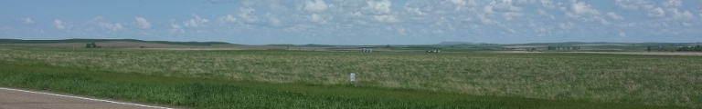
For the most part, the shores of Lake Michigan are rather straight and simple. One exception is the north-east corner, where it decided to a little crazy and form a series of bays and inlets. The largest of these is Grand Traverse Bay, which is so big, it in turn splits into two arms. At the end of that bay lies Traverse City, featuring lush sandy beaches and a grand old town strangely dominated by at least a dozen pompous bank buildings.
Over night, the rain had arrived, but it had calmed down a little when I was leaving the hotel. There was even a hazy halo of the sun to be seen behind the clouds in the east. Even though it was rather early, only seven o’clock, that sun was already far up. But early also meant that I had to brave the morning rush on my way out of town. I kept heading north, along the shore of Grand Traverse Bay (East Arm). The first town was Acme and I bravely refrained from buying any gadgets.
As if the bay wasn’t enough, soon there appeared a lake on the right side of the road, too. It had its very own town, Elk Rapids, mostly dominated by all thing holiday. Before reaching the next such lake at Torch Lake, two things happened. First, we crossed the 45th parallel which, as a sign helpfully pointed out, marks the halfway between the equator and the north pole. Secondly, it started to rain again.
The third lake on the right coincided with the town of Charlevoix. A canal had beend dug between the lake on the right and the greater lake on the left and the town laid out there. Main street was running along the short of the lake on the right and was thus houses on the left and parks and marina on the right. Just after town, there first was the Charlevoix Country Club with a giant, kitschy arc marking its entrance, followed by the Charlevoix Gun and Rod Club, whose entrance was marked merely by a sign.
Grand Traverse Bay was duly followed by Little Traverse Bay. Here, all tourist activity was conveniently concentrated in Bay Shore. It featured not one but two golf courses—one of which an exclusive Golf Club, yet again with tacky arcs—, a collection of large resort towers by the shores, and an assortment of shopping buildings styled as huts.
The real world caught up soon in Petoski. It, too, started out with an endless display of all the motel chains America has to offer with an odd mini golf course thrown in for good measure. Downtown was separated from all this by a very green gorge, which the road had to cross by way of a rather large bridge. Bay-side, things continued to be of a leisurely pace: parks, board walks, pavilions. This was followed by a display of old Petoski: pretty colonial villas surrounded by gardens. Eventually, though, the city ended in more modern day holidays.
The area remained rather settled with a hint of being tourist country. In Convay, two old preserved passenger train cars reminded of the early history of tourism; the train line long since converted into a cycle path. (Which does sound suspiciously like psychopath. Just sayin’.) Pellston was very busy with parked cars and people wandering about without displaying any obvious reason for all the hubbub. There even was a visitor centre, so maybe I should have stopped and asked.
Instead, I kept heading north until running out of land. Lake Michigan and Lake Huron—that’s the one to the right with no big city on—are connected by something called the Straits of Mackinec. For some reason, presumably of a historic nature, the Straits not only connect two lakes but also separate the two constituent parts of Michigan, known as the Lower and Upper Peninsula. The former, being in the south with connections to the eastern US, is the populous and busy part, whereas the Upper Peninsula is mostly just forests.
Luckily (or perhaps sadly), I didn’t have to take a boat to cross the Straits but for the small token of four dollars, I was allowed to use their giant bridge and arrived on the northern peninsula with as little fuss as possible. Which left me with no time for further planning, so I made a stop at the Michigan Welcome Center.
The northern shores looked somewhat promising but also a little lacking with convenient roads. For the most part, you had to venture north from a central road and then turn around. Since the weather also had taken a turn for the worse, I opted against such a venture and instead chose the route along the southern coast. Neither route had much in the way of side-streets, so I would have to bear with heavy traffic on either option.
Turning off the freeway and heading west, the difference in population density was very obvious. The road was running along the shore of Lake Michigan with hardly any houses at all. The forests had taken a turn to the coniferous, indicating that Canada and its boreal forest wasn’t far.
Apart from the odd village, such as Gulliver tht promised a gold mine, a trail head, and a light house, the drive was rather lonely, except for all the traffic of course. The weather got worse and worse, heavy rain now with very low clouds which eventually came so low as to turn into fog.
Which was the reason I couldn’t see much at all of Manistique, the next bigger town. It did feature a long chain of motels on the left of the road, presumably directly by the lake shores, but who could say. Many of the motels and restaurants featured a statue of a moose with a blanket for a saddle, but whether there was any specific meaning attached to it or perhaps there was just a very cunning maker of these things around, I couldn’t quite say.
After a mere forty miles followed the next settlement in the form of the two cities of Gladstone and Escanaba which had grown into a single urban area. Gladstone clearly and, given the name, appropriately was the prettied of the two, with its green centre tucked away to the left of the road. Escanaba, on the other hand, was your usual bland collection of one business after another along all available streets.
Thankfully, it ended rather quickly, though, and soon I stumbled into my last county in Michigan. This was celebrated by the giant institution of the Island Resort and Casino. According to the map, the county was already in Central Time, yet the giant clock at the casino chimed still in Eastern.
The map also hinted that a little west the option of taking a side road would arise. Instead of following the busy US highway west, I could go a little south to Carney, turn west there and venture along a series of county roads. Since traffic was still rather heavy, I immediately jumped at the option. The first county road would have indeed been lovely. Beset by trees on the left and meadows and the occasional house on the right, it wound along. Unfortunately, the rain had become torrential by now and the surface of the road wasn’t in the best of conditions. But who am I kidding: I loved it.
Eventually, a rather grand bridge over the very wide Menominee River took me unceremoniously into Wisconsin. Immediately not only the road became a lot better, but it also stopped raining. How could that happen? Even more mysteriously yet, I could see the end of the low clouds and blue skies not too far ahead in the distance.
The next county road, starting at the village of Amberg, proves my hastily erected theory that Wisconsin’s roads were in a much better condition than Michigan’s to a quick rest. This new road was also rather full of surprise turns, so I had to stop to rearrange my bag in the boot. By getting out for just that short moment, I attracted millions of mosquitoes, three of which even made it into the car and requiring a quick and bloody hunt.
The bends in the road were a sign that I had ventured into mountains again. There was hardly any sign of human live at all until the rather lovely Athelstane hidden away in the woods. Beyond the village, even the power line beside the road disappeared, a sure sign of impending loneliness. That only lasted for a few miles, though, until a nameless collection of cottages and assorted businesses in the vicinity of the Caldron Falls Reservoir. The county road ended at Wabeno, it too a pretty affair in the mountains. It featured a log museum which, perhaps in an attempt to become more exciting, had a tank displayed outside.
Another quiet side road took me back to the main highway. I could stand it only for a few minutes before deciding to leave it again, even if this meant a rather large detour. So, I turned left soon and was back into the world of quiet forest lanes. The real detour began at Pelican Lake. This new road was drawn in the map as being very zigzag.
The map was right. The road first followed the north shore of Pelican Lake providing access to the many private properties blocking of the shore entirely. It then went into a spring green tunnel of overhanging trees. The recent rain and the now returned sunshine made the green almost painfully bright.
Enjoying a few more bends and turns through the mountains, the road finally, too, ended at a north-south highway that quickly and unceremoniously dumped me into Rhinelander, the largest city around and therefore my quarters for the night.