Thursday, June 5th
Stumbling into the Boom
The morning started overcast and grey. Yet by the time I was done with breakfast and my writing chores, the clouds had disappeared and the sun returned in force.
Leaving Jamestown, I caught a glimpse of its Downtown. Like in most American small cities—Jamestown had a population of about 15,000—the centre was perhaps four blocks along main street. It seemed quite busy here with ample of stores. Off to the left a residential area began, set, once more, in a tree-heavy park. Meanwhile, the main street crossed over the railway station, complete with that most important feature of any prairie town: a set of grain elevators. The James River eventually served as a natural end of the city.
I headed north-west for a bit along the main highway until at Pingree the opportunity arose to turn west again onto an endless small road. As I intended to take the road all the way to its far end, the first milepost’s indication of eighty-eight miles to that point was somewhat helpful.
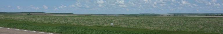
The landscape wasn’t quite as flat, though, and the road did quite a bit of, for lack of a better word: turning. On top of the first hill where two farms that shared a pond. There was quite a few more of these ponds along the way. Some of them were rather large, little lakes almost. The road had a tendency to just cut straight through these, perhaps the highway engineers were bored.
A swarm of large birds kept circling over the road. Depending on which way the birds were facing, the swarm was either bright white or dark grey. More birds where sitting in the grass by the roadside, taking off in the last possible moment. Unlike back in Saskatchewan, here they mostly got the direction right and flew away from the tarmac. Besides the red-shouldered species that I already knew from Canada, there was a new kind. It was all black as well yet had a bright yellow head, which looked quite impressive. A bird with its very own high visibility, well, hat.
Most villages were off the road and hidden away in tree groves: Woodworth, Pettibone, Robinson. The next village to drive through was Tuttle after crossing the next north-south highway. It appeared somewhat larger to the eye now trained in tiny villages. Grain elevators, even though there was no railway, a bunch of other buildings. Then back into quiet farmland.
Only towards the end of the road things became a little more busy. I returned onto a fast divided highway which had to twist and turn a lot because the landscape has not only become more busy but also quite a bit more hilly. The reason revealed itself after a short petrol and toilet break in Washburn. I turned off yet again only to cross the Missouri River. It was quite wide, certainly wider than the Mississippi this far north.
The road claimed to be something called the Lewis and Clark Trail. Thanks to popular culture, you probably have the wrong image in your head. Smallville is actually in Kansas. These are actually Captain Meriwether Lewis and Second Lieutenant William Clark who, between 1804 and 1806, commanded something called the Corps of Discovery on an expedition across what was then called Louisiana, had just been purchased from the French, and is now pretty much all of the Midwest, and onwards to the Pacific Northwest down the Columbia River to where Portland is now. They weren’t the first to do this trip, but as they staked the claims for the United States in the area, theirs is now being seen as a rather important expedition.
Back in the now, the road followed the Missouri River on the south side through an unsurprisingly green valley. It passed by the Leland Olds Station, a 669 megawatts dual-unit coal power plant. Not far was Stanton, a sleepy village by the railway well supplied with electrical power.
Perhaps thanks to Lewis and Clark, the area was littered with the brown road signs announcing tourist attractions. The next one was Knife River Indian Village. Perhaps I should have shown more interest, but I decided to carry on.
The road headed north and then sharply turned east, entering into Pick City. The, well, city was mostly a giant trailer park on the ridge of the Missouri valley. To the left of the street was endless flat farmland. To the right, perhaps two rows of houses away, was a sharp break and down it went a few hundred feet into the valley. Soon, the road turned right and plunged into the depths, too.
It did so only to arrive at Garrison Dam. Built during the late 1940s and early 1950s, the dam is the reason for Lake Sakakawea. Despite being 180 miles long, an entire page on my map, it is only the third largest man-made lake in these United States. It is two and half miles long and two hundred and ten feet tall. While I was crossing it, a sole worker on a little tractor was busy mowing it. Speaking of a Sisyphean task.
About three quarters across the dam is a little rest area. It separates the regular dam from the spillover dam which was mostly put in place to boggle the visitor’s mind with fantastic numbers.
After this extravagant little adventure, the road returned to the big highway which immediately decided to wanting to cross the lake, too. It did so together with the railway and a power line on a giant dam of its own. Strangely, only the waters to the left of the dam were Lake Sakakawea, while the waters to the right, really only separated by that dam, were Lake Audubon.
Right after the dam I turned off again and onto state route 1804, numbered so after the first year of the Lewis and Clark expedition. Yes, they are very proud of them here. The road followed the north shore of Lake Sakakawea (if I write this a few more time, perhaps I can spell it without having to check) in a right-angular prairie way. First, tough, it went through Garrison, a town with nothing to report of, really. Grain elevator, railway crossing, highway intersection, residential buildings surrounded by trees.
To be fair, the road wasn’t actually going very straight. The area was very hilly and it actually made an effort to avoid the worst inclines. Eventually, the landscape calmed down a little. On top of a hill just outside Parshall, two or three armoured vehicles were parked by a large radio antenna with a group of soldiers milling about. As for Parshall itself, I guess you can paint the picture by now.
Beyond the landscape become rather busy. There was plenty of factory-like buildings on the fields. Some of them had large girder towers that looked suspiciously like drilling operations. Soon the first oil wells appeared. The road had become rather busy too. The hub of all of the kerfuffle was a village poetically called New Town. It had’t been created for the oil people but was the result of the creation of Lake Sakakawea back in the fifties when it replaced two villages now at the bottom of the lake.
Since 2000, the town had doubled in size which was very busy. There was trailer parks and oil supply stores everywhere. Every square inch of the centre, a single block by the main road, was occupied by parked pick-up trucks with lots more swarming about.
I turned north trying to escape the madness but to no avail. Oil well followed after oil well. And since all transportation was done by trucks, the road was rather quite busy. The big advantage of America, though, is, that trucks aren’t speed limited and for most part powerful enough to not be as much of a nuisance as they are on European country lanes.
Clouds had been brewing above for quite a while, but now they decided to try out this rain thing they had heard of. First faintly, but then for real the rain brought with it that typical fresh smell.
Each active oilfield had a little torch where they burnt off whatever it is they burn off. Little actually was the wrong word, as the flames could grow quite large. As it was also quite windy, this looked rather risky but also quite pretty.
Landscape and road had become a little calmer for a while before busying up again as Williston loomed, the city at the heart of the oil boom. Much like New Town, it was madly busy, only at a much grander scale. The city obviously had earned enough money to adjust its infrastructure resulting in the entire town being one single roadworks site.
I had intended to end the day here and head south again in the morning. Inquiries at the local hotels yielded quotes that can best described as insane, about twice what one would normally pay. The map revealed a city called Glendive less than a hundred miles south-west on the Interstate that should have more affordable options and, if it didn’t, had a fast road to go looking for some.
Leaving Williston proved a long and plainful procedure, though, thanks to the devastating combination of heavy traffic and complex roadworks. Finally out, a few miles on the dusty and hopelessly traffic-drowned village of Trenton played home to a giant oil-loading rail yard. While there was road construction here, too, nobody had bothered to build a bridge over the railway and so I got to watch an endless oil train slowly push out of the yard backwards. Once it was through, all of us hurried across the tracks because the train was pretty much ready to start its journey north, thereby crossing the street yet again. And it was really long.
As a plus, though, I had left the clouds behind. They were still lingering en masse over the lake, but here, west of it, the skies were blue and entirely free of clouds.
Finally free of obstructions other than still heavy traffic, I headed south. A sign outside of Fairview welcomed me to Montana, a state I hadn’t actually intended to go to at all. It also meant that I had crossed into Mountain Time. So my this was my eighth state and third time zone.
By now I didn’t care greatly, though, and was rather happy when the sixty or so miles to Glendive finally were all covered and the city indeed had accommodation within my budget.