Wednesday, June 11th
No Creek
This morning I decided to take things slow and it was almost ten when I took to the streets. The towers of a large red building peeked out of the tree tops and I decided to go and find it. It took a few attempts to navigate the checkerboard mace but eventually I stood outside the gates of the Nazareth Convent. The building was indeed red, a large Romanesque brick building with a few spires. Erected in 1903 as home of the Sisters of St. Joseph it was still serving this purpose today.
Curiosity satisfied, I fuelled the car and took off. The map showed a minor highway, state route 9, twisting its way through the north-east of Kansas all the way to the state border. It looked perfect for my purpose. For the first few miles, the road was in the early stages of being resurfaced. So far, only the old top layer had been scraped off. This left marks in the road that made the tires sing in a whale song kind of way.
Yet again I crossed the Republican River, perhaps ten metres wide with trees overhanging its shoreline. Right after the crossing was Clyde. It looked rather wealthy for once: large wooden houses in the parks by the road followed by a row of two-storey shop buildings. There even was a hotel in an old building that for once didn’t seem abandoned or renting out by the hour.
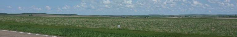
The country became rather busy: the fields were smaller and left room for more farm yards and their tree groves. There was a string of smaller towns, most of which off the road and only visible by their grain elevators sticking out of what seemed like a forest. Most of these grain elevators were of an older style, made from wood and sheet metal, not the concrete cylinders of today. It seemed I had left the West behind and had snug back into America’s East.
Blue Rapids was the next bigger town, yet it didn’t seem to have a commercial main street, or at least there wasn’t one by the main road. And really, the term ‘bigger’ has to be taken relatively here. The town was occupying the valley of the Big Blue River which the road crossed about half a mile after leaving Blue Rapids. It climbed out of the valley and then continued straight east. Straight, really straight.
Frankfort, up next and also somewhat bigger, started with a railway crossing and had a main street again. After, a large brown building in front of a small park carried a sign announcing its ongoing renovation. Despite being brown and large, it didn’t quite look like a school. But then, it wasn’t ugly, the third required property of a school building.
Beyond, the string of small towns continued. They all had a collection of small wooden houses hidden away from the road by trees, one or two stone buildings at the central intersection, a grain elevator towards the end and a water tower atop a nearby hill. Everything was rather quiet in the pleasant warmth of a summer noon. In between villages, the road ran between fields with the odd farm yard. If this was home, then perhaps there really was no place like it.
But the end was nigh. It came in form of Atchison, a city of ten thousand down by the Missouri River, eastern border of Kansas. I came in through the back door and got a good look at one or two large factories and the rail yard. The centre looked much more appealing. Up top a hill was a residential area with stately homes. To the south below was the shopping district and to the east the river banks had been converted into a lovely little park. I stopped there for a little break.
From the park, it was easy to spot the bridge and subsequently easy to find. It was named the Amelia Earhart Memorial Bridge who was born in Atchison and let across the Missouri River into Missouri state.
Before getting there properly, the road had to cross the river valley in a long straight line. Once, this valley was more or less a muddy swamp with the river changing its course ever so often, leaving behind murky ponds and dead lakes. Now its was orderly dammed and the valley handed over to settlers and farmers.
The east side of the valley was marked by a ridge covered in a thick forest. The highway couldn’t but follow the base of this ridge. It kept doing that, but soon there appeared a gap in the wall, the course of tributary, a side road bolted off east. By the looks of the map, now back at the larger scale, it seemed to continue the idea of the mornings highway, so I took to it.
Winding heavily, it climbed up and out of the Missouri valley. But even after that was done, the landscape remained rather hilly and full of trees. Houses started to appear everywhere—I was back east for good. About an hour later, the land became a little wider again. The hills became longer and more smooth. The fields were still rather small compared to further west with tree lines marking the boundaries and the many creeks and rivers.
The first proper town was Plattsburg. It started as a park with many grand colonial houses. I was about to remark that there was no commercial main street, when it appeared in a side road with a row of two-story brick buildings. None of it seemed desperately in need of paint. Really quite pretty.
The road bypassed the centre of Lathrop but next to it, a small suburb of semi-detached houses had sprung up. The presumed reason came soon: an intersection with the motorway leading to Kansas City only forty miles away and thus in good commuting distance. Actually and, at least a little interestingly, there is but two Kansas Cities. One is indeed in Kansas, but the larger one and containing the downtown area, is Kansas City, Missouri.
After crossing the motorway, the road became unpleasantly busy. I left the eastbound highway and started zigzagging north-east. Slowly the landscape became wider, the fields larger and the trees fewer. The towns became fewer but larger, around fifteen hundred people on average.
Gallatin started out normal enough, houses under trees. But coming around a bend, I spied a large stone house. And surely enough, Gallatin had a prestigious court house complete with a southern-style central square around which the main street ran.
I crossed the Grand River which was reasonably grand, and came across an array of horse cart warning signs. Jamesport, it appeared, had a sizeable Amish community, even though neither the town nor its people could be seen from the road. The farms that were visible all had the usual collection of tractors and pick-ups.
Onwards to Trenton, the landscape became even flatter yet there were more trees again. In fact there was a surplus of trees and, according to a sign by the road, there were trees for sale.
Trenton, marked on the map as a larger town, was indeed larger but still lacked desperately in the lodging department. Having intended to end the day here, I instead turned south again towards the oddly named Chillicothe. A stern sign by the road suggested that the penalty for littering was a year of jail which sounded a bit excessive to me.
I crossed the adorably meta No Creek before arriving in Chillicothe. Known as the Home of Sliced Bread—the first commercial sliced bread was made here–it doesn’t get any better. Or rather it does. While the hotel selection was slightly better than in Trenton, they were all booked solid. Seemed I had run out of luck a little. Grudgingly, I drove the hour or so east to Macon, which didn’t have a satisfying selection either but at least here were rooms to be had.