four
Transit
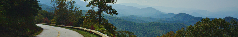
The westernmost parts of Virginia rest between Tennessee, Kentucky and West Virginia like a giant cartographic wedge. Travelling north-east, I cross the state line back into Virginia and immediately the road becomes freakishly narrow. It winds along the side of a green, sparsely populated valley. There would be enough space for a straight road, but it prefers to hide in the flanks of the neighbouring mountains.
As it progresses towards the main highway, the valley becomes increasingly more populated and the road dares leave its hideout. A significant number of residences sports entrances marked by stone deer on pillars.
I cross the fast dual carriageway and start to follow the Clinch River upstream. At first, the new road is fast and wide and straight, but soon it starts turning to the left and never stops. Something clearly isn’t right. But at least these curves are wide. Later the turns become narrow again and average speed drops.
I realize how Virginia is so much better road signed than the other states. Each and every road, be it as a dual carriage way or a tiny dust strip, has a number and that number is clearly stated for every road turning off. Better yet, there is an advance warning for each intersection stating those numbers, too. Nigh impossible to get lost.
After Dungannnon, a slightly more dense collection of buildings than normal, the road turns north and leaves the valley for the mountains. There isn’t much space, so it resorts to a rather mad set of hairpin curves. It only calms down after reaching the next river valley. It avoids the centre of Coeburn using the freeway, finds a valley to follow for it bit and goes back to hairpinning. For a while, there is only lone forest, but civilization is soon to return.
Clintwood is even big enough to have both a Mc Donald’s and a Pizza Hut. The other end of town sports a selection of industry along the valley floor. This industry produces an endless procession of big dump trucks along the highway—fortunately going in the other direction. When I finally catch up with one going my way, it is about to turn off south.
I keep going north-east, through the village of Clinchco and into a narrow valley with only river, road, and rail. That valley ends in Haysi by merging with another, not much wider valley. The entire town has turned into a giant flea market, complete with bouncy castle and, God forbid, pedestrians.
Another narrow valley on, the neighbouring towns of Vasant and Grundy, both lying in the same slightly wider yet steep walled river valley, have merged into a single undecipherable conglomerate. The entire commercial sprawl of a small American city has been squeezed into this valley endlessly along one road. To make room for the necessary intersections, the odd mountain had to be removed.
Eventually, the city ends but the urban sprawl continues. Slowly it calms down as we approach the next state line. To reach it along a mountain ridge, the road has to climb and bend a bit. It does so, finally, in quiet forests.