Friday, June 7th
Red, White, and Yellow
Hurricane is a rather hot little city in the valley of the Virgin River. While it was a hundred degrees yesterday evening, at eight in the morning, the temperature is more pleasant eighty. After having breakfast out, I eventually drive off around nine. The road leaves Hurricane by way of a bridge over the gorge of the Virgin River and, at the same time, enters into the smaller neighbour of La Verkin. It stays there only for a short moment before deciding to leave the valley climbing up into a higher valley.
If the name of the gated community by the road, Desert Garden Estates, is anything to go by, we are back in the desert, even though steppe is probably the correct term. Red rock ridges protect the valley on both sides. Fort Zion, appearing to be an old fort complete with wooden palisades and tiny wooden houses but seeming suspiciously fake, stands by the left side of the road. But the name suggests what is to come (and why one would build a fake fort here): Zion National Park, featuring very high on everyones must see list.
But first, we rejoin with the Virgin River which has made itself a lovely, green valley here in what otherwise is a dry, rocky canyon. The town occupying this valley consequently is called Rockwell, population 247. The walls are very steep and don’t leave much space, making the homes having rock slides right at their back doors. Springdale follows right after in a similar fashion. Both communities cater for the park tourist with endless lodges and hotels and arts and crafts stores.
Springdale also has several parking lots and a shuttle service into the park right at its northern end. Its main feature is Zion Canyon, a deep canyon of the North Fork Zion River in between majestic yellow sandstone walls. Unfortunately, the lack of space and the sheer number of people have convinced park management to not allow private vehicles into the canyon outside of winter. Instead, you have to take a shuttle bus.
I ponder that option for a bit but eventually decide against it. I do have some traveling left to do and this is likely to take forever.
Instead, I follow the main road crawling up the side of the canyon mad hairpins affording increasingly majestic views of the canyon’s rock faces. Pretty soon, the road runs out of space to climb and instead enters a tunnel. While this tunnel would qualify as generously spacious in Norway, around here it has to be temporarily blocked for one direction whenever a larger vehicle approaches.
On the other side there still isn’t much space and the road winds through yet another gorge with stunning views. The rock faces are red and yellow and beige, arranged in layers which shift in weird curvy lines across or form a hazy veil. Trees in fresh spring green cling to every possible corner.
The road leaves Zion Park and returns into the relative normality of a mountainous forest which takes it down into the valley of an old friend: the Virgin River or, more correctly, East Form Virgin River. Here, too, has it formed a fertile valley in an otherwise rather dry world. There is several villages, Mount Carmel, Muddy Creek, and finally Orderville, where the river takes a left turn while the road swings into a side valley. It goes on through Glandale before reaching the end of that valley, too and having to resort to climbing again.
It is thus back in the mountains with green grass valley floors and pine forest at its sides leading into the valley of the Sevier River and a landscape similar to the Virgin River’s valley.
Eventually appear a petrol station and a motel, marking the turn-off towards Bryce Canyon, the next National Park on the list. But first, there appear ridiculously red rocks and a narrow gorge again, surprisingly named Red Canyon. A sign warns of tunnels, but they are only twenty metres each which hardly qualifies for that title.
Once out of the canyon, it is climbing time again, soon leading to dense pine forests. A village of cottages and shops and petrol stations signs the imminent arrival at the park. For those that don’t get the hint, there is a large stone monument at the actual entrance. Most parks have these monuments allowing people to stop and photograph themselves in front of the park’s name as some sort of proof.
The low speed limits and hordes of drivers with too much time at their hand also mean that I can enter National Park Driving Mode again: air conditioning set to OFF; window set to OPEN.
Still no sign of any canyon, though, but rather dense alpine forests. I take a quick stop and study the map they kindly give you at every park. It appears that the park essentially is along a close to twenty mile long, southbound road that has lookout points ever so often on its east side. The main attraction fairly early along the road is called the Bryce Amphitheatre where I am headed first. The parking lot still and mysteriously is in the middle of a forest and won’t reveal anything.
Only once you walked a couple of steps do you arrive at an edge and have a stunning view into a giant bowl (or amphitheater if you are more poetically inclined) spreading out before you. It opens straight ahead making the endless plains and far-off mountains the stage. The spectators, meanwhile, are dozens, if not hundreds of red rock pillars, called Hoodoos.
There is more scenes like this along the road, but none quite as grand again. Perhaps a close second is a stone arch blasted into a cliff by wind and rain at a place called Natural Bridge (a nit-picky sign pointing out that the name is wrong, since natural bridges are formed by rivers or streams).
The park is surprisingly full of cars with California plates, quite a long way away (says the man with two thousand miles on the clock already). French people seem the dominant non-Americans and have been at Grand Canyon, too. The Dutch, as ever, stand out by having brought over their own camper van. Of the motorbike crews, there is suspiciously many Germans. Is this a new thing?
I spend altogether too much time in the park and it almost turns two as I leave. There is at least one more National Park nearby, plus a bunch of state parks, but it is a hundred mile trip to get there with another ninety miles to get back into civilization, so I will have to skip Capital Reef (which probably means it is the prettiest of the bunch). There also is Arches National Park which apparently abounds in natural stone arches, but it is even further to the east and time is running out.
But even if I skip the park, it takes a hundred and sixty miles back into civilization. That tour starts off with descending down into the valley similar to what was visible from the Bryce bowl: red rock smokestacks with green trees everywhere. All very messy. Soon, it becomes more regular mountain valley and very lonely; long stretches of empty road between the rare villages. The valley becomes greener again when it joins a currently dry river whose bed is covered with white sediment, perhaps salt. The valley is of medium width with vertical walls on both sides, forcing the road to swirl about.
The central town of the valley is Escalante, administrative seat for the various parks around. But that doesn’t mean it is big. A few buildings sits on a windy hill at the end of the stretch of the road.
Instead, it pulls upright and concentrates again: a set of hairpins leads into a valley of yellow rocks, only to be followed soon by even mader hairpins into a red canyon. It twist along what little space is available, fighting for it with the vegetation, seems to loose this fight and takes the first opportunity to rise out again by way of more hairpin curves. Up top at the rim of the canyon it seems more comfortable but still his to wind quite a bit, affording majestic views down into the canyon on the left.
But soon, similarly majestic views peek through the trees on the right as well. The rim turns into a ridge which the road, quite amazingly follows. At one point, the ridge is exactly as wide as the road with steep walls on either side. I have seen similar with hiking trails before, but never with roads.
Driving is great fun or would be, if it weren’t for a sober speed limit of thirty-five miles per hour.
Eventually, the canyon to the right ends and the road swings around to its other rim and backtracks along it. But not before spawning a side road that keeps going along straight along the original rim. Unfortunately, it is only a dirt road, so I stick to the main highway. It turns left again soon, crosses the ridge and rolls into yet another green valley, this one being host to the village of Boulder. Either a rather small settlement or merely covering a lot of space, there is only few buildings by the road which strangely keeps insisting on going along a ridge.
It also starts climbing again towards a mountain range. And keeps climbing. Into a pine forest. Out of the pine forest and into Aspen groves. Out of those too and onto bald mountain tops. A sign belatedly suggests a ‘scenic overlook’ which I accept with screeching tires. The view is truly spectacular. It reaches out over the huge drainage area of Escalante River, bounded only in a hazy distance by mountain ranges, one of them being Henry Mountains, home to America’s last free roaming Bison herds, or so the display claims.
I spend a few minutes enjoying the few and the warmth of the sun, but there is miles and miles of road ahead.
Soon enough, the road reaches its climax at not quite three thousand metres. These is the Aquarius Plateau which was visible and pointed out already at the vista points above Bryce Canyon, hours ago.
Down again in wide curves, past an access point to something called the Great Western Trail and into Wayne County, the sign to which someone improved by adding an initial D. Red mountains again for a moment, then back into a green valley. I notice the junction to Teasdale just in time and roll along a quiet shortcut road now. I also enter farm land, brought to you by the wonders of irrigation.
The floor here is relatively flat, except for the odd yellow rock mountain thrown in for good measure. Heading for another red rock formation in the distance, the road enters the little farming community of Teasdale. It features a number of pretty wooden houses and a rather ugly modern red-brick church.
Back on the main road west and running along the aforementioned red rocks, there is three more farming villages: Bicknell, Lyman, and Loa. It seems that around here people prefer villages over lone farms as they often do elsewhere in the country.
The fertile valley ends after Loa, or rather, the road opts to leave it and climb again without much ado up to 2,500 metres and back into wilderness. But down the other side is the next farm valley already, this one even sporting a real-life lake, Koosharem Reservoir.
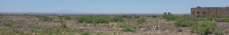
Just one more ridge to cross and, as I seem to be doing at the end of every day, a long, fast descend into a wide valley towards Richfield, chosen overnight location. Down, there awaits a farmer’s dream. The farm yards are spread out again, wooden structures, old, new, abandoned and crumbling, old cars and trucks rusting on the yards.
Richfield is smaller than I would have expected from the map. Not sure how they determine the writing style for the town names, but it doesn’t seem to have anything to do with population. But not to worry, Richfield sits next to an Interstate highway and provides for all amenities, even a Radio Shack downtown to purchase a power cable for the laptop after I negligently left the adapter in Flagstaff.