Fourteen
It is a two hour drive from Salinas to San Francisco. If you take your time. I have to drop off the car half past three at San Francisco Airport. And I don’t want to be too early since then I may not be able to check into my hotel in downtown San Francisco right away. So, I have to stretch two hours into more like six. The map reveals a highway that leads through the Santa Cruz Mountains that confine Silicon Valley to the West. Parts of it are called Skyline Boulevard.
On the way back to the coast, I cross through Castroville. It styles itself the Artichoke Capital of the World and holds an annual Artichoke Festival in May. Shortly thereafter I am back on highway 1 for the last time. Around here, it is a busy road connecting Monterey County with the city of Santa Cruz. The center of which seems to be domintated by Mexicans. They hang around a gardening center probably waiting for someone to offer them a job.
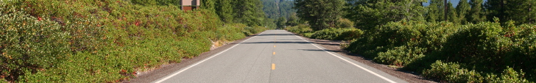
North of Santa Cruz the road starts winding again. It leads through woods into which cottages, villas, and ranches have been dispersed liberally. They get more sparse once the road starts climbing into the mountains. Up top, I turn left into Skyline Boulevard. It sticks to the ridge and leads northwesterly through forests and meadows allowing views to the right down into Silicon Valley and to the left towards the coastal mountain on top of which loom the clouds brewing at the Pacific.
Before long, the fun ends and the options are left or right. I turn right down into Silicon Valley with the vague plan to have a look at Palo Alto. This means taking highway 101 south (actually southeast) for a bit which is a freeway with the number of lanes varying between four and eight or so per direction. At the exit I turn left into East Palo Alto which seems to be the poor latino sister of Palo Alto proper.
Turning around and driving into Palo Alto, then, I end up in a traffic jam slowly sneaking through University Avenue. The town looks nice enough. Many trees along the road, small shops. But no parking. There are also millions of red traffic lights so I have enough time to study my various maps. I decide to have a look at Stanford University but first drop by Stanford Shopping Center to grab some food. Being outdoors, the center comes rather close to a European pedestrian only shopping street. The mall also has an Apple shop where I finally get to try out one of these spanking new iPhones.
Stanford University doesn’t seem to want visitors. At least there is no free parking. I do the American thing instead and just drive once around. It sure is big. It is also rather empty since the semester hasn’t started yet. Or has it and it really is that empty all the time?
I turn into El Camino Real, the royal road. Originally, it was connecting 21 missions in California between San Diego and Sonoma. Nowadays and in the Bay Area it mostly connects all sorts of businesses. It is not a freeway but rather a normal American commercial road. The fifteen miles from Palo Alto to Milbrae take forever. The traffic lights are co-ordinated in the same ingenious way as in Oslo. You hit at least every second light at red, though the average is probably more like one and a quarter. In Milbrae I fill up the final time and clean up the car. SFO, the San Francisco International Airport is just accross the freeway.
It takes an hour to drop off the car, since they can’t find my contract in their mobile computers, possibly because I return the car two days early. So I have to queue with all the new arrivals in the rental car office. The bill shows the final distance at a bit over two thousand miles.