Saturday, June 7th
Great Reservation
After a night of clouds and rain, the sun had returned. The skies were clear and so was my head. Time I finally went south.
The one surprising feature of Dickinson was the large amount of apartment buildings. In most smaller American towns, you hardly see any. But here, perhaps yet again because of the oil, they were lining the main road into town. The centre ran along the railway line which the southbound road dived under. This particular line must have been rather busy to warrant such an expensive treatment when normally a simple level crossing has to do.
A few more businesses and houses before the Heart River marked the end of town and the road returned to grassland. There was tree groves here and there, normally where there were farm houses. While the landscape was rather flat, the now straight road had to perform frequent ups and downs. The road was, in fact, so straight that you could see every single bend on the rather small scaled map. And it only bended to reach New England, a village build atop a hill by the side of the Cannonball River valley.
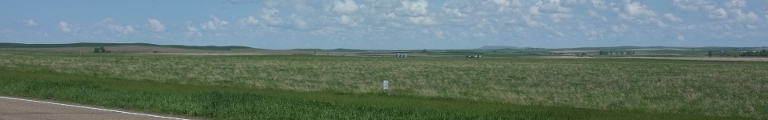
I turned east into an ever flatter landscape, except for some, finger quote, mountains at the horizon. A giant steel sign suggested something called the Enchanted Highway, to be found off back to the north soon. Apparently, it was worth seeing as now there was lots of oncoming camper vans until the intersection. I decided against a detour and kept heading east on a now again quiet road.
Or almost quiet, because the road served as a resting ground for a strange species of flightless birds (at least they kept running away not flying away) that looked a little like tiny T-Rex. One could imagine the comic sound they were making when running away hurriedly.
I reached the aforementioned mountains at Mott, again a village on a hill top and again by the Cannonball River. The road struggled a bit to cross mountains and the river valley before finally being able to return to its calm straightforward being. More mountains appeared, but these were single cone shaped specimen, one complete, the others half eroded, and easily averted.
New Leipzig was next and you know the drill by now: hill and Cannonball River. After, a overgrown dam to the roads left, later right looked suspiciously like an old, abandoned railway. Indeed, both the location and name of New Leipzig had been due to that railway. The settlement, called just Leipzig, had originally been eleven miles away but its people decided to move in 1910 to be right by the side of the railway and called the new location New Leipzig.
It is not the only village here, in fact there are plenty. Maybe it is the German ancestry that makes people want live together in villages rather than everyone in a remote farm on their ranch.
Down the road in Elkin, traffic was stopped by the sheriff to let a demonstration cross. There was a poster for an election campaign, so perhaps it is what it was. In any case, true to the area, the demonstration was held with pick-up trucks and tractors, not with a march on foot.
I was allowed through a gap in the procession and continued eastwards. The road dived into a valley complete with lake and nameless river. Eventually I turned south and immediately, the road started a long decent into an expansive valley. Soon the culprit was named, no other than the Cannonball River, which had returned from a little trip south and was heading east towards the Missouri. I decided to do the same.
Just before reaching the Missouri, though, the road ended onto a north-south highway which was marked as the Native American Scenic Byway. The map suggested that this label started rather abruptly a few miles north, so I went to find out why.
But first, a side road turned off to the village of Cannon Ball. Since the Cannonball River had been such a faithful companion this morning, I decided to have a look. It was less a village, though, then more a collection of nearby farms, plus a school house. All of them were sitting smug by the river—which had started to become Lake Oahe—in a peaceful world of tall green grass and bushy trees, birds singing and time going just that little bit slower.
The road ended abruptly at a farm gate; I turned around back into the now.
The byway really did start out of the blue. Or almost. It does start at a bridge over the, yes, Cannonball River which marks the northern boundary of the Standing Rock Indian Reservation. This starting point shouldn’t have been a surprise for a byway that crosses through various Sioux reservations in both North and South Dakota.
Satisfied with the answer to that riddle, I turned around and south. A few miles on I came across an important feature of every reservation: the casino. This one was a rather ugly concrete building erected, it seemed, on top of a parking lot. Strangely, there was hardly any advertisement for it. There had been a sign by the road at the entrance to the reservation, but that was about it. Perhaps there wasn’t enough strangers travelling through and the local gamblers knew where to turn.
The road approached a large body of water, still the Missouri River and Lake Oahe twin. A collection of large ugly brown buildings, a sure sign of a school, announced the arrival in Fort Yates. The school was to the right of the road, the village set back quite a bit to the left in a flat valley part of the otherwise rather hilly landscape. On the right followed the Sitting Bull College and a few more, unlabelled larger buildings before the road climbed back into the hills.
Eventually, the hills calmed down a little. Off to the left, there were now a few cone-shaped mountains with their tops sheared off. Sometime at that point the road crossed into South Dakota. I only noticed that after the village of Kennel when the highway shield had a different layout.
Onwards, the road started to decent into a valley full of water. To the left was the Missouri River in its lake incarnation. Suddenly, another river, the Grand River, appeared on the right. That couldn’t go well for all too long and soon the road crossed the Grand River by way of a long concrete bridge, followed directly by an intersection.
Had I turned left, I would have crossed the Missouri, too, and had come to the town of Mobridge. Yet I turned right, up the hill and out of the valley. Then left again into a road running south high above the shores of the now joint rivers. This wasn’t the road I was planning on, though, but a short cul de sac towards the Sitting Bull Memorial.
Sitting Bull, famous bane of Lt. Col. Custer, was originally buried near Fort Yates, but his remains where moved to the top of a hill overlooking the river valley in 1953 and a memorial erected. It was a most serene place. Atop the hill stood a small statue of the chief looking south amidst endless grassland. The silence was only interrupted by the permanent angry call of the cattle grazing nearby and, more subtly, by the wind rustling the grass.
Back by the main highway and a lot less serene was the Grand River Casino and Resort, also atop a hill, presumably as its own advertisement.
Shortly thereafter, I turned into my actual road south, a small country road that started out great, winding through the hills, but soon became straighter but also more and more broken. It wound up in a landscape of rolling hills yet devoid of any tree.
This went on for quite some time: grass and cattle and nothing much else. Finally, around a bend, the river-cum-lake returned and a giant steel girder bridge pointed out where I would be crossing it. On the other side, things became rather alarmingly flat. But at least there was trees again. When it stopped being flat and hills returned, the reason for the river’s transformation come in sight: Oahe Dam, yet another dam project of the 1940s.
Just a few hills south of it, I arrived at Pierre, the capital of South Dakota. Chosen as such mostly on grounds of being pretty much smack in the middle of state, it is the second smallest of all state capitals and home to not even fifteen thousand people. I checked into a hotel and, on account of this being Saturday, went to a steak house about five miles out of town.
Now, a piece of advise: Having a twenty ounce steak (that’s a bit more than half a kilo but how should I have known that) if you have to drive five miles back isn’t the smartest of choices, even if it is an excellent and miraculously tender prime rib. Having learned that the hard way, I added a little walk on the way back and stopped by the state capitol.
The capitol, a very important feature of a capital, particularly of a very small one, is the seat of the legislature and generally a very pretty building in a park. South Dakota’s capitol was build about twenty years after its statehood in the twentieth century’s naughties. It is a fine neo-renaissance building with four wings around a central dome. The grounds feature large trees and, off to the east, a lovely little lake. A park to the north marks the end of the city and the begin of the surrounding green hills.
A train was whistleing its way through town, a church bell chiming, and the sun slowly climbed down towards the western horizon. Time to return to my chambers and start digesting.