Sunday, June 8th
Rainlands
It was still sunny during breakfast but the clouds were coming in fast. By the time I was ready to go, the first raindrops were popping up on the windscreen. This, then, would be a second rainy day.
Undeterred I headed out of town. Its end was just west of hotel in the form of the Missouri River. It needed to be crossed by both the road and the railway, each on their own bridge, one concrete, one steel. On the other side was Fort Pierre, the older yet smaller of the two settlements. Strangely enough, the river separated time zones. Pierre was in Central Time while Fort Pierre was in the Mountain Time zone. That must have been a rather complicated arrangement for the locals. All this time zone hopping surely was messing with my head at least.
A sign at the end of Fort Pierre announced that the next services would be available in 66 miles. Even though the machine said I had about two hundred miles left in the tank, I turned around and fuelled up. No need to have that nagging feeling around for the next hour.
Thusly prepared, I tried again. Past the sign, the road wound out of the river valley, returned to the flat plains, and stopped winding altogether. Nothing much happened until Hayes, five houses and a roadside stop by a pond full of RVs. Outside, there was a little brown church in a field by the road named, unexpectedly, Little Brown Church.
Now the rain started for real.
The main road west decided to turn south for a bit, yet there was a smaller route that would keep heading west, so I took that one. Right after the intersection, it had to climb quite a bit to master two hills, each with an antenna on top, the road running through the ‘pass’ between them.
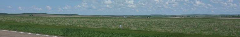
Beyond, grassland beckoned, entirely devoid of trees. It was still rather green. This may not have been entirely normal, though. According to locals, there had been an unusually large amount of rain that made for a rather pleasant prairies this year.
The road continued through those green fields, but eventually I had to turn south, too. More green fields before I returned to the main west road at Philip, a surprisingly large settlement that had it all: road, rail, and a water source in form of the Bad River. Maybe the water source wasn’t that good, after all.
I went south a bit further and turned onto the Interstate west. All along the road, in intervals at most a couple of metres apart, there were billboards announcing the many exciting things available at something call Wall Drug. Eventually, the succeeded in convincing me to go there, but really only because something that big must have restrooms which slowly had turned into my number one priority.
Subsequently, I turned off the Interstate at Wall and followed the not very subtle sign. They had changed a little and now solely promised free parking—a bit strange as I hadn’t paid for parking on this trip even once.
The action happened along one city block of street. There was plenty of parking, indeed, but even on this rainy day (or perhaps especially on this rainy day), everything was full. This doesn’t stop drivers from cruising around and around hoping the eventually find a spot. Never mind that one block away down by the railway line there was a giant parking lot for this very occasion.
The Wall Drug Store itself was a large wooden market hall full of various stores and food establishments. There may even have been an actual drug store in there. Another wooden hall offered the opportunity to take your picture in mock-historical settings or shop some more. And, there was restrooms.
Back when it first opened, the store had been a rather small business in a town of three hundred people out nowhere. But then in the 1930s tourism took off for good and hoards of people started coming this way through the sweltering heat of the summer prairies. All it took was some of those still ubiquitous signs which back in the day promised free ice water.
Even better yet, in the 1960s a national park opened just south: Badlands National Park. This was where I was heading now.
For some unexplained reason, the speed sign just out of town also marked the speed limit in kilometres per hour, about the only such sign for hundreds of miles either direction. If you haven’t figured out how much 55 mph is by now, a sole sign wont help you much either.
A bit further on, another sign informed visitors that prairie dogs have the plague. A whole lot more effective then just warning of the dangerous wildlife. It is not just dangerous, it has the Black Death. There wasn’t much risk of seeing any prairie dogs in this weather, though. It still rained relentlessly.
A mile or so after the entrance to the park it became obvious that these badlands really are. Off to the right side of the road the green and flat prairies broke off. The subsequent rim featured a collection of barren stone towers and chalk heaps, muddy in the rain. Then, a few hundred feet down, the prairie continued innocently as if nothing had happened. Or almost nothing: muddy beige streams took away the excess chalk.
Like most national parks, there was a road for motorist visitors such as myself. Here it went once through in a mostly easterly direction. It started out along the rim, then went down for a bit and up again, running along the northern rim of the badlands yet again.
On the upper part a short board walk went into the grassland. Here you couls see how it used to be once before it had been turned into farm land. Duly wet from the walk, I returned to the road. I started mocking all those people in their Winnebagos for having their grand vacation ruined by this rain until I realized that I was in fact on a grand vacation, too. Well, as the saying goes, d’oh.
Having stuck to the rim for a while, the road eventually went down for good. Included in the decent was a trail showing and explaining fossils found in the area. The area looked rather muddy, I had just about blow-dried myself, and really had never seen the attraction of fossils to begin with. So I rolled on. Down, the road meandered through the spiky mountains that looked a little as if some giants had tried to build mud towers.
Just for fun I stopped at the head for something called the Saddle Pass Trail right by a beige river. A series of metal poles indicated where the trail would go: straight trough a giant field of sticky mud. No need, really, for the sign suggesting that this wasn’t a good idea if wet.
I left the park turned south and then west again through the lower prairies. The landscape was mostly flat but here and there was a line of those mud-tower mountains. I crossed through a bit of park again, easily recognizable by being barren and chalk. It seemed that this was the point where the road climbed back onto the upper prairies. Beyond lay the valley of the Cheyenne River where there finally was trees again.
Up and out of that valley, a green dinosaur was standing in a field. Best I could tell, it was fake.
The road stumbled across another river, Rapid Creek, and decided to follow it all the way to Rapid City. So had done a railway line to its left. It must have been removed not too long ago as there was still a giant stack of old sleepers.
I passed through Rapid City, population about 65,000, without seeing to much of it. I had intended to continue on a side road, but missed the turn and stayed on the main road west. Beyond town it suddenly started to climb and a steep mountain valley appeared. Pine trees appeared, too, and soon there was entire pine forests. These were the Black Hills, a mountainous fluke in the plains, the tallest peak being 2,207 metres, compared to the not quite 1,000 metres of Rapid City.
Naturally, the area served recreational purposes and, it being Sunday, I got stuck behind driver after driver who apparently hadn’t seen mountain roads before and was rather afraid. The authorities had been comprised of the same people setting rather careful speed limits—not that that was necessary as nobody seemed to reach them, anyway.
Finally, I did reach Deadwood, a resort town nestled into a deep mountain valley towards the northern end of the hills. Back in the olden days it became notorious as a gold rush town with all the mayhem that entailed. Now, only the historic centre was left, designated a National Historic Landmark District (the things that exist in this world …), and a rather alarming number of casinos. The centre indeed is rather pretty, mostly comprised of two and three storey red brick or stone buildings. The ensemble had been ruined by someone insisting that the streets should be covered with red brick, too.
Toying with the idea of spending the night, yet another casino appeared and that tipped the scale: onwards I went. Only a few miles north was beautifully named Spearfish. What it did not seem to have was beautiful accommodation though or maybe I had grown picky by now. I decided to hop onto the Interstate and travel east towards Rapid City until I found something nice. As luck would have had it, Sturgis, only twenty miles on, indeed provided what I was looking for.