Tuesday, June 10th
Three Heel Clicks
My original intentions for the trip only had gone as far as Mount Rushmore and followed up with a vague ‘Get back to Chicago.’ I now had four days for that with a distance easily covered in two and a half. A detour was called for, so after much deliberation, I decided to take a swing to the south.
The day promised to be sunny and warm again. I headed out of Scottsbluff on the road I had come in the night before. Not impeded by being tired, I now had a good look around. The landscape was properly flat and used mostly for grain farming. Off to the south was a step up in the landscape, visible through its rocky face.
To increase yields, many farms were supported by an irrigation system. The most system in use practically everywhere used a central water supply with a sprinkler arm up to five hundred metres long rotating around it. If you have ever flown over the central US, you probably have seen the circular fields resulting from this. The trouble with this ever-present irrigation is that it is slowly sucking up the ground water table under the great plains as it isn’t refilled quickly enough.
Meanwhile, I had turned off yesterday’s route and were now entering Bayard, mostly consisting of a series of single storey brick buildings along main street plus a railway crossing with a little railway museum. After, the road crossed over the North Platte River, a rather lazy and shallow affair snaking along the flat lands.
Ahead, a funny-looking, lone mountain came into view. It looked like a stone needle was placed atop a cone. It turned out its name was Chimney Rock and it had its very own visitor centre, perhaps a mile off the highway. Its parking lot was plastered with signs warning of the rattle snakes in the area. Apparently, they really meant it. And indeed, as I headed back to the highway, a snake, perhaps a metre long, was lying on the road. Funny, how some deep racial memory triggers and gives you the creeps just seeing these things.
Next up was Bridgeport where two main highways met which meant that there would be petrol to be had. After fuelling, I turned north for a short bit. The road first crossed the North Platte River again on a rather small bridge which was trumped by the tall railway bridge after. These height of these bridges stems from the custom of American railways to stack two container atop each others making for a rather tall profile and requiring expensive bridges.
Just beyond the bridges the map suggested a town called Northport, which seemed to be pretty much only the railway line grain elevator for the area. It did also house yet another highway junction so I could turn south-east again.
The road was now running parallel to the railway line which was rather busy with coal trains. In the forty-five miles to Oshkosh I overtook two loaded trains heading south. They seemed to be running along at forty miles an hour and, if I counted right (which was unlikely), consisted of 145 cars hauled by two and pushed by one extra locomotive. Assuming my research is right, too (also unlikely), this would make a train 2400 metres long. No wonder it took forever to pass.
Shortly before Oshkosh, the road decided it needed to get onto the other side of the railway line again, thus requiring another tall bridge which the road got to by taking a giant swing to the left. Oshkosh itself was yet another prairie town.
There seemed to be some track works going on stealing one track from the otherwise double track railway line. This resulted in a queue of northbound, empty trains on the line after Oshkosh. Two were waiting on the few miles until Lewellen, rather full of trees, so the river must have been nearby. I turned off here and as part of that had to cross the railway not on a bridge but on a normal crossing. Kindly just before it, the third train waited.
After a few miles, a lake became visible to the right. It started out rather funny looking with lots of stumps sticking out of it. Whether these used to be trees and the lake was expanding or whether this was actually some kind of reed, I couldn’t quite make out from the distance. There was, however, a village with the appropriate name of Marina that consisted mostly of trailers and mobile homes.
The road kept running alongside the north shore of the lake, which became a more regular water-only lake further on. Every once in a while a ‘public road’ went down to the shore as part of the Lake McConaughy State Park which meant payment was required to travel those roads. At the east end of the lake, the main road swung over the dam that of course was here and the reason for the lake.
I, instead turned off and followed the river for a bit downstream before crossing it just outside a village named Keystone. After the bridge over the now somewhat swallower river, the road climbed out of the river valley and up the side that had been visible since Scottsbluff, even though it was a lot less steep around here.
Beyond followed slightly hilly farmland in the next river valley, this one of the South Platte River. This valley, too contained its very own railway line, this one also very busy but with trains of a more varied nature instead of just coal. I followed along for a while before turning south again just outside Sutherland. For crossing the railway, there was yet again a giant bridge, then the river, then the Interstate motorway and finally a climb out of the valley.
Up top the artificial walls of a reservoir could be admired which eventually ended at the giant Gerald Gentleman Station power plant. From here on it was back to flat plains, straight roads and grass land. Plant farming mostly only happened on a few fields around the villages. Turning west at Wallace, their number started to increase. The landscape slowly turned into something that wouldn’t have been out of place in Northern Germany: slow, rolling hills interspersed with flat segments; fields and ranch land with the occasional tree grove hiding a farm yard.
The villages, all somewhere around five hundred people give or take a few hundred, were all of the same basic pattern: grain elevator by the railway line, a main street that went off the highway and had a series of single-storey brick business buildings, a garage by the highway and, every third village or so, an ugly big brown school building.
The next bigger town was Holdrege, the bigger size allowing for two-storey businesses along main street. The map promised a shortcut south-east, but I missed it and had to do a little swirling to get back on track, now southbound.
A few miles before crossing into Kansas, the landscape finally changed: It became a lot more hilly with plenty of tree-rich river valleys. The first one of these was home to Franklin, the last town in Nebraska. It head a fighter jet and two tanks on display next to the baseball field. Everything else was in desperate need of a new coat of paint or two. The river’s valley didn’t run through town but snaked along perhaps half a mile outside.
The up the hill again and into Kansas. There is no place like home.
The fields continued with a mixture of plant and cattle farming and the road running straight through. At the state line it had to move a little off to the right to align with the new state’s grid. About ten miles on it reached the main east-west highway and I turned east.
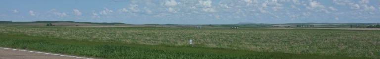
The map promised the ‘Geographic Center of the 48 Contiguous States’ just north of Lebanon. I had to go see. Lebanon had a lot of abandoned houses by the highway, perhaps people had moved to quieter places. North of town a small road turned off and after about a mile I reached a rather serene place. There was a small white chapel with a few picnic benches under a few large trees. A stone with an inscription and a wooden sign both marked the spot. The sun was still far up, it was pleasantly warm, the only sounds were of birdsong and the wind in the trees.
But, it was getting rather late already and I headed onwards, further east then a little south to the only larger city for miles and miles: Concordia, nestled in the valley of the Republican River. Luckily, hotel rooms were available and I could end the long day’s drive.