Monday, June 3rd
The Long Road
It has struck half past nine when I finally get to go. The sun is out and Aspen’s main road is rather busy. As I leave town, I ponder whether to like it or not. Sure, it is refreshingly un-American with its bike lanes and frequent bus services and downtown parking fees. But like all things tourism, it feels rather fake and misplaced. Its ski resort revival (after failing as a mining town first) even has a founding myth around a wealthy industrialist, one Walter Paepcke, building the perfect hiding place serving both body and soul. The spiritual pokus worked and drew in the artsy folk followed by the usual second wave.
East of Aspen, the valley walls draw slowly closer and develop a more Alpine feel. The trees still carry their early spring outfit of piercing light green, before being replaced by large rocks, lying around or hanging dangerously over the road. The road, consequently narrows, sometimes to only one lane, stressing out the driver in front of me and leaving me grudgingly impressed.
A sign points to the somewhat ill-named ‘Lost Man Campground.’ Further on, the remains of mine entrances remind of the older, first story of the valley. Another such reminder is Independence Ghost Town. The town (not yet ghostly) jumped into existence in 1879 after a gold lode was discovered nearby. Prospering for a few years, the lode proved small and soon everyone rather left; a wise choice given the local weather. Now the town is an archaeological site and a nice stroll. Or would be, if the trails weren't still covered in snow and mud.
Instead, I drive on, further up to Independence Pass. At 3,686 metres the short walk to a view point is rather exhausting. The effects of altitude, much like jetlag, something whose existence one will never believe until experienced firsthand.
The slopes down the other side needs to be mastered in a series of hairpin curves until we reach the valley and follow it further down in a more gently fashion. The mountains to both sides are really tall, though. One, Mt. Elbert at 4,399 metres, is Colorado’s highest peak.
The valley floor turns ever more swampy, eventually resulting in a lake. And then a second lake, as the name of the village of Twin Lakes suggests. Said village sports a sudden thirty miles-per-hour speed limit in a road otherwise allowing sixty five, a fact well known to the local sheriff who lurks readily by the road.
By now, the landscape has shed its Alpine feel altogether. We are back in drier grassland with those small evil bushes. A sign announces the beginning of the Arkansas Headwater Recreational Park. Indeed, the Arkansas river, running more than two thousand kilometres through four states, giving its name to one of them, has its source a few kilometres north.
I turn south and start following the river for a while. It is still rather mountainous here, even though the valley grows wider and wider. It is itself rather hilly, though, and the road has to swirl widely. The town of Buena Vista rather effectively uses the entire available valley. Quite unexpectedly it has various motels to choose from, a nice park along the highway in the centre and, according to a sign, even a brewpub. A pawnshop runs the slogan ‘Pawn all: guns, gifts, gold.’
The river apparently develops a bit of a temper, as indicated by a huge white-water rafting operation, complete with a giant welcome building, a stairwell down to the river, school buses for transportation.
Ever since Buena Vista the road has been very busy. Seems everyone is on their way to Salida, the largest town in the area. Taking a shortcut off the US highway, we come in through the back door and get to see a rather pretty downtown. Maybe five blocks worth of old brick buildings are well maintained and evidently still in use by local businesses. The normal commercial madness is running along the main highway quite a bit to the south.
Said highway starts to follow the Arkansas river, too, which rises to the honour and presents Bighorn Sheep Canyon. It is rather wide with relatively benign walls, but since they are all rock and no plants, they still pose a risk to the highway, which bravely winds through. At some point after Swissvale, a pretty village with lots of gardens, it even presents an electric warning sign for a dangerous bend which turns out to be not that dangerous at all.
The river has a few more canyons in store before we reach Texas Creek (a couple of houses at a river bridge) and I turn south. The new road winds its way out of the valley and reaches a plateau with big mountains in the distance. These mountains turn out to be the right boundary of a rather wide valley. Some weather is brewing over them, but ahead all is clear. The valley floor is grassland with hardly any larger plants.
Its centre is Westcliff, a pretty frontier town, well maintained with quite a few business still open. I fuel up the car, embarrassing myself by not finding the button to open the tank. Why does every manufacturer has to hide it somewhere else? This one has it as a tiny black button on the driver’s door.
The road continues for another hour or so through the valley. There is something calling itself pompously the Silver West Airport when it really only is a bunch of sheet iron shacks. It does have a paved runway, though, which runs along the highway, maybe thirty metres to its left.
A huge sign warns to ‘Keep Out! Buffalo are extremely dangerous.’ Naturally, I can’t see any buffalo at all (and not just because it is actually a bison). The landscape has meanwhile turned karst with steep-sided trenches dug in by streams. Some of the mountains in the distance look suspiciously like volcano cones.
Eventually, I reach Walsenburg, elevation 6185 feet or 1885 metres, so we are still rather up high. Walsenburg also is an Interstate junction and I shall take to the fast motorway for thirty miles or so south. The road runs by Ludlow and a sign points to the Ludlow Massacre Memorial, remembering an attack on striking miners in 1914 leading to further violence in retaliation. Shortly before reaching Trinidad, I leave the Interstate and turn east again.
The landscape has become rather flat now with some hills added for entertainment. The mountains are a mere backdrop, perhaps ten miles to the south. I will have to cross one hundred and twenty miles of this to reach Springfield with only two named dots on the map in between. This feels someone long at first, but one quickly adjusts to just driving along, not expecting it too end anytime soon.
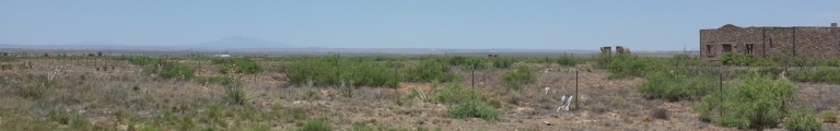
There isn’t much to distract. An odd river valley, the turn-off of a road to the south, complete with a lone store and two house, occasionally an abandoned, ruined house, even more occasionally intact structures, such as a gas pipeline plant or a cow shed.
The village of Kim eventually appears on the horizon, not unlike a mirage. First, we pass by a rather large farm, then a smaller farm, then a ninety degree left turn, more farms and eventually the village itself: Kim, elevation 5690. There isn’t much to it, a school, some businesses, some homes. Quickly it all ends and the road ninety-degrees again, this time to the right and back east.
The next interruption is Pritchett which is visible from far away through its three grain elevators. While those are still in business, the rest of town doesn’t seem to be. Pretty much all shops are closed. Instead, beyond town someone is trying their luck farming llamas. And, where there is grain elevators, there must be grain fields which sure enough start now, too.
Only a couple of minutes now and we can see Springfield, population two grain elevators, in the distance. We won’t go there, though, but instead finally turn south onto a fast US highway. Towards the left, something big is brewing. There are dark clouds, getting ever more darker and developing fingers pointing down. Looks all rather spooky but thankfully remains east of the road which, in fact, seems to form the eastern boundary of the storm.
Instead, the road runs through Campo, carefully, though, since it looks as touching it would make it all tumble and fall. Two turns (and seven miles) later, signs announce both the state of Oklahoma and the central time zone. The latter means that it is suddenly an hour later and past six already.
Boise City is next. The road runs past a large metal dinosaur and a baseball field with kiddy league training in progress straight towards the town’s court house. Three more roads are doing the same and meet by way of a large roundabout with the court house in its centre. I swirl around, onwards south past a few factories, mostly grain related it seems.
Not much later and I am done with Oklahoma already and enter the Great State of Texas. The large, happy welcome sign is riddled with bullet holes. Welcome, indeed.
The country has turned rather desert by now. There is still grass and the odd tree, but mostly yellow rocks and dirt. This is pretty much exactly how one imagined Texas, sans the strong wind that is blowing.
I arrive in the city of Dalhart, of which I have never heard before either but elected to be my quarter for the night. I have a somewhat hard time finding accommodation, but this apparently is normal and explained with the cattle trade in which the city has specialised. But I manage to snatch the last room at one motel and a bit later head out for a Texan dinner: steak. The steak house is a bit of a strange experience. Residing in a large sheet aluminium building with not a single window, it is about as cozy as the restaurant of an East German holiday resort. Except that service is a whole lot more confused, though the waitresses are trying to make up for it by coming by the table every three minutes asking if one needs anything. But the steak sure is good. And it is not their fault that I find the concept of a salad bar ridiculous.
Watching their clientele is, well, interesting and stereotype confirming. Perhaps a steak house is the wrong place to judge the average weight of a Texan, but, oh boy.