Thursday, June 6th
Gorgeous
This morning I mysteriously turn into a proper tourist. The route I will be taking today and at least tomorrow is the one most often suggested to people new to this whole Driving Through America thing since the area around the border between Arizona and Utah has a surprisingly high density of National Parks.
I am a bit wary of the consequences this might have for traffic, but as I leave Fallstaff by way of its handsome brick downtown near the very busy train station (albeit only with endless, double-stacked freight trains), the road quietens down quickly.
There is a one-hour difference between the network-supplied time of the cellphone and the stubbornly continuous car’s clock, even though Arizona definitely is part of Mountain Time like Colorado and New Mexico. They just don’t seem to believe in daylight saving time and thus effectively and confusingly join the Pacific Time zone during summer.
The road climbs up from Flagstaff’s 2,100 metres to 2,452 through dense pine forests of the San Francisco Peaks containing the highest mountains of Arizona. Once it has mastered this formidable barrier, it descends onto an endless relatively flat plains of small trees and sand: I have finally crossed the mountain range I entered around noon yesterday.
The plains does have the occasional lone volcano mountain sticking out of it, such as Red Mountain right by the road. It’s name, for once, is quite befitting as its northern flank is a giant vertical cliff of red rock.
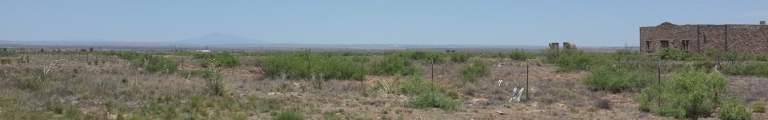
After leaving Kaibab National Forest, signs of human settlement return in the form of the occasional farm. One of them even has a solar panel roof. The more enterprising forms of settlement are evident at the intersection with the road from Williams. Although the spot doesn’t seem to have a name, it features shops, B&Bs, a western style traders store, petrol stations, RV park, giant motel and an air museum. Now the road does get rather busy. Seems that most visitors travel up to Grand Canyon National Park, the first and only park on today’s list from Williams as does a railroad line.
The endless plains eventually do end and the pine forests return which mark a second outlet of Kaibab National Forest. A mere two miles before the long-awaited entrance of the National Park, Tusayan suddenly appears, a town full of motels and fast food joints. A sign pronounces the Good News that ‘Grand Canyon Proudly Recycles.’ Just a little queue at the entrance and I am in. So far, the driving wasn’t all that bad—fingers crossed.
The first stop is Mather Point nearby the central parking lot and the visitor centre and, yes, the central bus stop. The idea seems to be that you leave your car here and hike along the rim of the canyon. When you are fed up with that, there is a nearby stop of a shuttle bus taking you back. The most westerly parts are only accessible by foot and shuttle bus outside of winter altogether.
So, first view of the world famous Grand Canyon at Mather Point. It may be overexposure with images of the canyon or, I think more likely, the sheer size of it that make it not quite as eye-openingly impressive as I had hoped. Eight miles across at this point and eight hundred metres deep, it has the effect of a photo with too much stuff in: everything just blurs together. That said, the vertical and near-vertical cliffs, the cone mountains with rocks on top inside the gorge and the contrast of the canyon’s rocky dryness with the rather lush forests up here are quite a thing to behold.
I make another stop at Yavapai Point a bit to the west before taking the road east. There are a few more points to stop at, too, before coming to Lipan Point almost at the end of the park. It sits on top of a rock elevated above the surrounding area and sticking out into the canyon, allowing for an unobstructed 180 degree view. And what a view it is. To the left you can see right into the lowest, deepest gorge of the Colorado River with rapids that, even from miles away, look wild and scary. Straight ahead and a little to the right, there are more tame parts, where the river is wide and calm, collecting its watery breath for the rapids. There are even some green meadows there.
I remain a while to enjoy this much improved view before driving on to Desert View, the eastern entrance of the park featuring an old watchtower. It is a bit of a walk to the tower, through a landscape that around here is more dry with smaller trees. While temperature isn’t all that high, upper seventies claims the car, the sun is burning down relentlessly at this noon-ish hour (with all those time zone shenanigans, who can tell the exact time?).
Just beyond the park begin the lands of the Navajo Nation, marked by regular parking lots with sales points in improvised wooden shacks. The road runs down into a side valley featuring a flat desert landscape. Or it would weren’t there a sudden, abrupt gorge, maybe fifty meters wide and who knows how deep winding along the floor. It may just be typically me, but this sudden menacing and more human scale interruption is a whole lot more impressive than the giant canyon.
What’s more, the landscape does look a lot more like the movie West now. There’s red rock cliffs to the right featuring those typical horizontal lines of rock layer stacked on rock layer. Some of these layers are sticking out while others have rotten away more quickly. The ground is mostly just dirt beset with those small, thorny shrubberies. This seemingly goes on indefinitely into the distance.
Frequent and large billboards announce the imminence of Cameron Trading Post, a shopping, lodging, entertaining operation with the road coming straight up from Flagstaff. It’s giant parking lot is full of white monstrous camper vans. The road, connecting Flagstaff in the south with Page about eighty miles north, is freakishly busy. It passes several, seemingly nameless settlements of a few houses each. They seem to be a more humid spots in the otherwise torturously dry desert. Most seem to have a church, one also has a school with a lone yellow school bus parked next to it. The houses are mostly mobile homes.
Traffic calms down suddenly, since road works force people driving to Page to take a forty mile detour. The announcements were a bit sudden and I hope this detour doesn’t apply to me too. But since there is still opposing traffic, I am hopeful.
The road road climbs out of a valley it was following all the time, red rock cliffs to the right and more accessible dirt hills to the left. At The Gap, only featuring a petrol station but not the store by the same name, I panic-buy more water. I still have plenty, but the dry landscape and beating sun makes you worry. I also buy a sandwich that turns out to still have a frozen centre. I place it on the dashboard for a quarter hour or so and all is well. I also have to put my sweater on, since I developed a sunburn on the left, window-side arm and, as always, forgot to bring sunscreen.
At Bitter Springs, I reach the intersection where the road towards Page indeed is closed and barred, leaving a few drivers miffed. My road, however, is open. It passes by a rather large church with a horse grazing in its garden. Then it dives down into Marble Canyon, as the gorge of the Colorado River is called here. A cluster of maybe three real, very green trees looks completely out of place. Up ahead, a dust devil swirls round and round.
The road goes down a bit more, turns left and suddenly comes up to Navajo Bridge where it crosses the Colorado. The original bridge from 1928, with only one lane, has been replaced by a new wider road bridge and was subsequently converted into a foot bridge. Strolling across, one has the most stunning views into the 140 metre deep and 250 metre wide gorge of the river, vertical red walls on both sides and the river framed by green shores below. Beyond the bridge loom Vermillion Cliffs, more vertical red walls which the road will follow for the next half hour or so.
Temperature has finally risen to a hundred degrees again as I walk back to the car pondering how little things may be much more impressive. But maybe that is just a very European perspective.
Eventually, the cliffs turn right, the road quickly crosses the plains and starts to climb into the mountain range across. This is trusty old Kaibab National Forest again, incarnation number three. Just a few hairpin curves up and suddenly there is thick pine forest again. Amazing, how little it takes for that to happen or seize. While the bridge was at around twelve hundred meters elevation, the road climbs up to 2,414 metres.
I make a quick fuel stop at Jacob Lake, where the route to the North Rim of Grand Canyon National Park branches off. But it being three or four already, I don’t quite have time for that rim anymore and instead drive on, back down into thorny bushes land and to Fredonia, yet another village with houses hidden in orchards. While it has a petrol station and a motel, there are hardly any other services. I turn off left here onto what promised to be a quiet side road on the map but is rather busy in reality.
It leads through Kaibab Indian Reservation and by Pipe Spring National Monument. It consider having a look but decide to just drive on and look up what I missed later. Turns out Pipe Spring is a well in the desert that has long been there and hence is rich in native and settler history. I also ponder the question what exactly National Monuments might be. Apparently, they are the little sister of the National Parks, not needing the approval of Congress but also receiving less funding.
Up beyond Pipe Spring on the right a mountain range has appeared again with red cliffs glistening madly in the evening sun. The road follows the range that forms the north-west boundary of a wide basin. It climbs out of it eventually but beyond is another plains but with desert replaced by steppe.
A sign announces the North Canyon Justice Court, which turns out to be a small government-style building in the middle of nowhere. Or at least a couple of miles outside ill-named Colorado City, not being in Colorado state or anywhere near Colorado River. The cities Wikipedia article is quite entertaining (this is Colorado City, Arizona) stating that the city is essentially controlled by an extremist Mormon sect or perhaps two and adds various skirmishes and stories.
The city also lies directly at the border with the sixth and final state for this trip: Utah, slogan ‘Life Elevated’. It starts right away with the town of Hilldale, being really just the Utah extension to Colorado City.
The road now crosses over what a sign calls Apple Valley before making a mad dive into deep and wide valley of the Virgin River and into Hurrican, serving as tonights overnight quarters.
Note: The next instalments of this series are likely to be delayed unless I can replace the power adapter that is still in Flagstaff. Judging by the size of upcoming towns, chances are slim.